Building survey
Acquire a thorough understanding of your building through detailed 3D modeling, 2D drawings, and a comprehensive technical assessment

We offer building surveys, 3D modelling, and technical inspections
Regardless of whether you need to get a building use permit or are planning a refurbishment, a building survey is an integral part of the technical assessment.
This documentation provides invaluable data on the dimensions and characteristics of the building's above and below ground structure. It is vital for ensuring compliance with safety regulations and serves as a reference point for future maintenance, inspections, and condition assessments.
How is a building surveyed using laser scanning?
A building survey is a comprehensive assessment that employs cutting-edge technologies to provide a detailed and accurate representation of a property.
Laser scanning is our preferred method for obtaining highly precise building surveys.
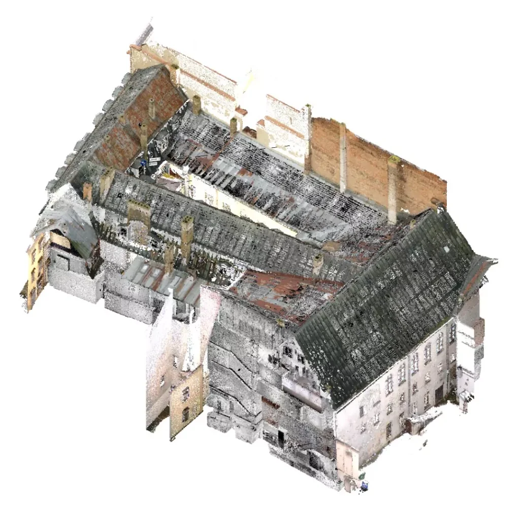
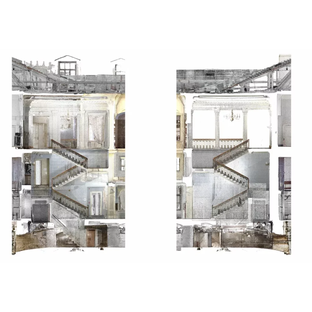
Initially, a laser scan of the building and its structures is conducted. The point cloud generated from the laser scan contains information about the object's location in real-world coordinates, referenced to the LKS92 TM and LAS-2000.5 systems.
Based on data obtained from laser scanning – a point cloud – detailed 3D as-built surveys are produced for the structure or building and its existing elements. This 3D model serves as the foundation for subsequent design work.


How is building surveying done with a drone?
There are instances where laser scanning may not be the most efficient method to obtain a 3D model.
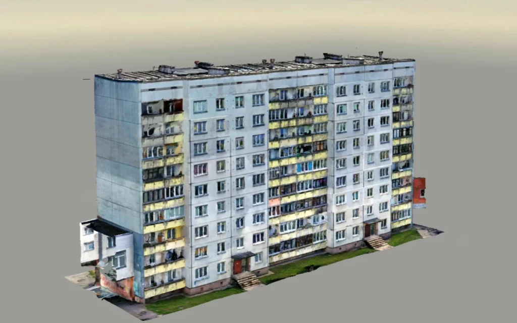
To capture a highly accurate point cloud of the site, we employ drones equipped with high-resolution cameras as an alternative to laser scanning.
The resulting images are processed with reality modeling software Bentley Context CaptureDuring processing, aerial triangulation is performed by determining the relative position and orientation of the images, attaching them to coordinate support points, and generating the final product.
The accuracy of the generated model is assessed within a tolerance of 3 cm compared to the actual field survey points.
Learn more about building surveying during a free consultation!
Fill out the form, and we will get back to you within one business day to confirm a suitable time for a consultation.
We'll work closely with you to understand your specific requirements and provide tailored architectural and design solutions.
Included as part of our free consultation:
- Answers to all your questions
- A tailored package of services for your project
- A step-by-step guide to working with us
- A competitive quote to suit your budget
Frequently asked questions
How much does a building survey cost?
Building surveying costs vary depending on the planned use of the building, location, current condition, other additional technical survey parameters and other equally important aspects.
If you want to know exactly how much the building survey of your project will cost, contact usand we will definitely help you!
What technologies are used to survey buildings?
Construction laser scanning technologies can be used in the surveying of buildings, as a result of which the obtained point cloud is prepared according to the LKS92 TM and LAS-2000.5 systems in object drawings in 3D format or in a 3D model, which serves as a basis for design needs.
A drone or aircraft with a high-resolution camera can also be used. The images obtained in this way are processed with reality modeling software. Bentley Context Capture. During processing, aerial triangulation is performed by determining the relative position and orientation of the images, attaching them to coordinate support points, and generating the final product.
If you want to learn more about what technologies can be used to implement your project's wishes, contact us today!
How does cooperation work?
Cooperating with us is simple - after a free consultation, we will create an individual offer, which we will fulfill, respecting your wishes and all the highest quality requirements.
Step 1: Application. Apply for a free consultation on our website or by writing to gatis@baltsunmelns.lv, calling +371 26118682.
Step 2: Free consultation - During the call, we will listen to your wishes and offer the best way to help you realize your idea in reality with design and architect services!
Step 3: Evaluation. Our specialists will evaluate the existing documents.
Step 4: Meeting. We will meet in person and agree on all costs.
Step 5: Contract. We will prepare a contract and start designing.
Step 6: Execution of works. We perform the work within the terms specified in the contract and with the highest quality.
What is a building survey included in a building survey service?
What types of buildings require a survey?
In order to ensure the safety of building users and the public, any type of building in which people live or will live requires a building survey before it is put into operation, as well as in situations where building reconstruction is planned or after accidents in accordance with the law. They can be private houses, apartment buildings, office buildings, public buildings, hotels, production plants, etc.
Can the building survey be included in the technical survey?
Yes, our office provides a full building survey service, which includes detailed building surveys.
If you would like to know more about what is included in a technical survey service and how it or a building survey can be used directly to realize your project wishes, contact us today! contact us today!